Ocoee District & Polk County, TN Early Land Records
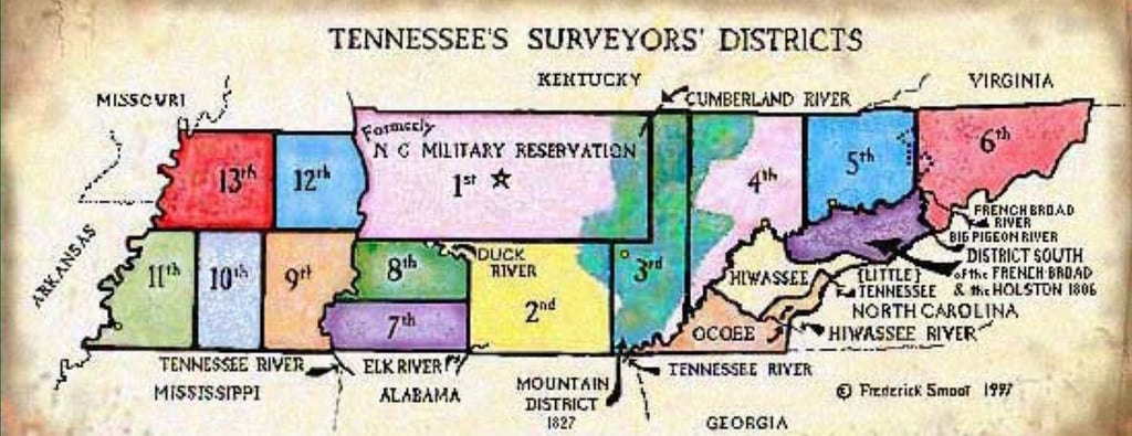
The 1836 East Tennessee District - The Ocoee District
In 1833, “... the laws and jurisdiction of the State of Tennessee ... are hereby extended to the southern limits of the State, over that tract of country now in the occupancy of the Cherokee Indians ...” Here was the Cherokee’s last holdout. Then came the Ocoee District in 1836.
Located in the southeast corner of East Tennessee. “That the public lands of this State ceded by the Cherokee Nation of Indians to the United States by treaty of the 23rd day of May 1836, shall constitute a surveyors’ district, which shall be known by the name of ‘Ocoee District’ ... ” In this treaty, called the Treaty of New Echota or Treaty of Removal, the Cherokee Nation ceded all lands that were owned, claimed or possessed by them, east of the Mississippi River. The treaty also provided for the removal of the Indians, two years after ratification.
We can set the boundaries from existing maps: the State Line on the east and south, the Tennessee River on the west, the Hiwassee River on the north. Also, a small strip of land north of the Hiwassee River and west of the Blue Ridge. There were survey conflicts between the Ocoee and the Hiwassee Districts, involving the exact placement of the dividing line between the two Districts. This involved islands in the Hiwassee River and similar claims among other things.
The office of the Surveyor General of the District was established at Cleveland, Bradley County.
Email Contact:
claydohsf@gmail.com
Clay Hooper © 2025. All rights reserved.